Santa Barbara County Last-Mile Broadband Program Environmental Impact Report

Project funding
- $1 million Local Agency Technical Assistance grant from the California Public Utilities Commission administered by the County of Santa Barbara.
Status
- Scoping(June 2025)
- Technical Study(Summer 2024)
- Draft PEIR(Winter 2024)
- Final PEIR(January 2025)
- Certification(Completed Feb. 2025)
PROJECT DESCRIPTION
SBCAG certified a Programmatic Environmental Impact report (PEIR) for the Santa Barbara County Last-Mile Broadband Program (Broadband Program or Project) in February 2025 to streamline future broadband construction by public or private providers. The environmental review covers common installation methods such as buried fiber, aerial cables, and satellite service.
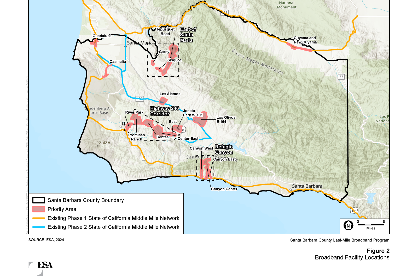
Nine last mile priority areas were identified, designed and included in the environmental work. The nine, last-mile priority areas include: Guadalupe, Cuyama/New Cuyama, Casmalia, Los Alamos, Los Olivos, Jonata Park, areas east of Santa Maria, Refugio Canyon, and the West Highway 246 corridor.
These last-mile facilities were designed to connect to the State of California’s “middle-mile” broadband network (Statewide Middle Mile Network) currently being implemented by the California Department of Technology (CDT), which will ultimately be 190 miles of middle-mile broadband infrastructure along the coastal rail corridor near Vandenberg Space Force Base, Lompoc, and the Gaviota Coast, with additional buildout planned along Highway 166 through Cuyama and the communities of Santa Maria, Orcutt, and toward Santa Ynez. The Middle Mile Network is expected to be completed in the region by the end of 2026.